UPDATE: A Winter Storm Watch has been issued for portions of the Baltimore area.
Original story below…
———
BALTIMORE, MD—Both the probability of snow and total expected accumulations for Saturday morning in the Baltimore area have increased.
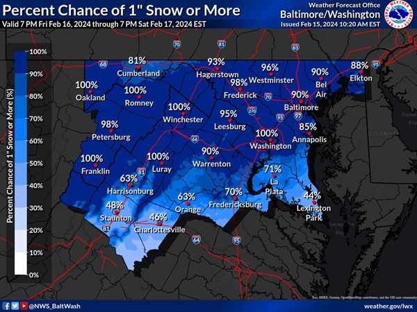
The National Weather Service now says there is a 90% chance that the Baltimore area will see 1 inch or more of total accumulation as a clipper system passes by the region late Friday night and into Saturday morning.
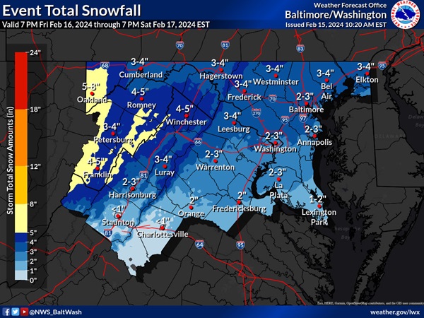
Earlier in the week, it looked like the Baltimore area could see a dusting to 1 inch of snow, but now forecasters say to expect 2 to 3 inches of accumulation – and some parts of northern Baltimore County could potentially see 4 or 5 inches of snow.
A Winter Storm Watch has been issued for western Maryland, where 4 to 6 inches of snow are expected, with isolated spots getting 8 inches.
The precipitation is expected to begin late Friday night and wind down by late Saturday afternoon.

Do you value local journalism? Support NottinghamMD.com today.

