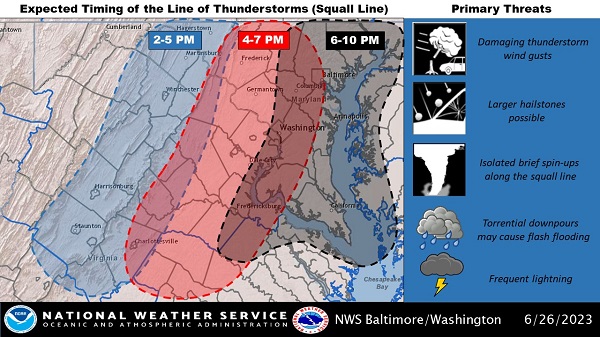
UPDATE: The National Weather Service now says the greatest threat for severe weather will be between 2 p.m. and 10 p.m.
Original story below…
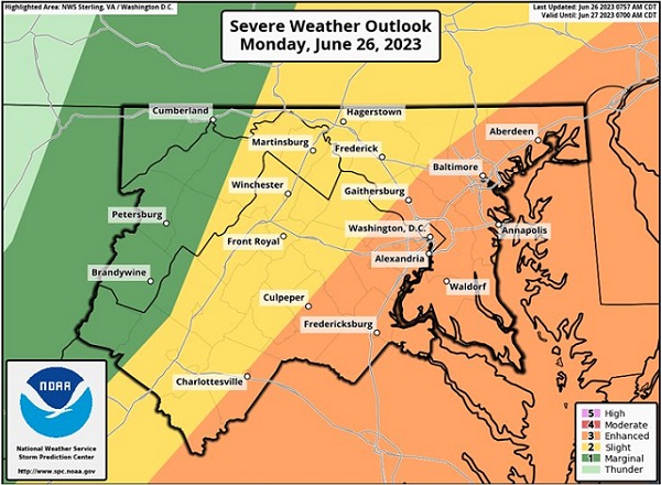
BALTIMORE, MD—After spotty storms move through the area on Sunday, forecasters say severe thunderstorms and even some hail are likely in and around Baltimore on Monday.
The National Weather Service says a strong system arriving on Monday will bring an increasing risk for severe thunderstorms and flash flooding.
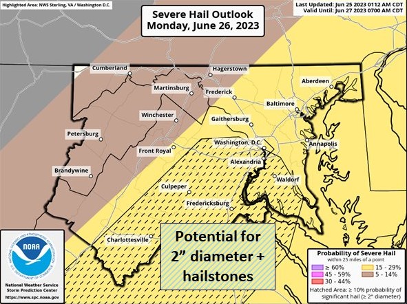
Some could produce 2″ diameter-sized hail. A few tornadoes are possible as well, with the worst of the storms arriving 3:00 – 7:00 p.m.
Tuesday will turn slightly cooler but storm chances persist on both Tuesday and Wednesday.
Residents should stay tuned to local forecasts. Additional information can be found in the NWS graphics below.


Do you value local journalism? Support NottinghamMD.com today.

