UPDATE 2: A Severe Thunderstorm Watch has also been issued.
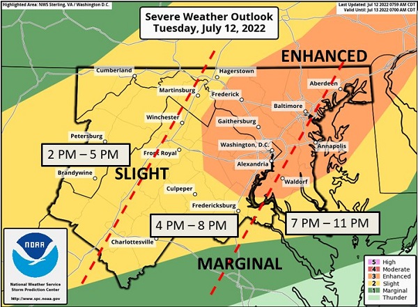
UPDATE: The potential for severe weather in the Baltimore area has increased. An updated graphic from the National Weather Service can be found below.
Original story below…
——
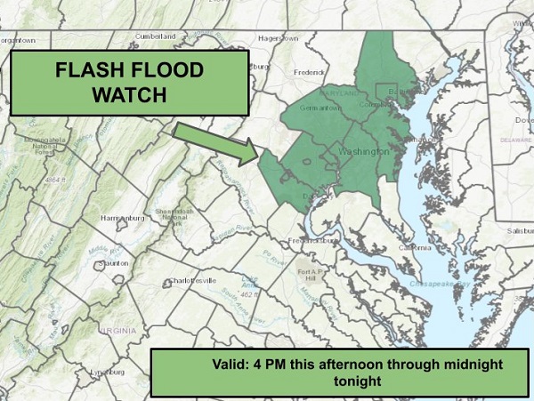
BALTIMORE, MD—The National Weather Service has issued a Flash Flood Watch for the Baltimore area.
The watch will be in effect from 4 p.m. on Tuesday through the evening hours.
Forecasters say there is the potential for severe weather Tuesday afternoon and evening across much of the Mid-Atlantic, especially along the Baltimore-Washington DC corridor.
Damaging winds will be the primary threat, but some hail and a few tornadoes are also possible. Rainfall rates of 1 – 2″ per hour are also likely.
Residents should stay tuned to local forecasts throughout the day.

Do you value local journalism? Support NottinghamMD.com today.

