UPDATE: Forecasters have provided a severe weather arrival timeline for the Baltimore area here.
Original story below…
——
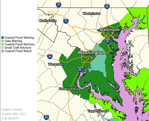
NOTTINGHAM, MD—The National Weather Service has issued a rare Coastal Flood Warning for the Baltimore area, as forecasters are expecting one of the biggest tidal flooding events of the past 10-20 years…possibly since Hurricane Isabel in some areas.
The warning will be in effect from 6 p.m. on Thursday evening through 8 a.m. on Saturday morning.
A Coastal Flood Warning means that there is the potential for unusually high tide levels that could result in flooding.
Forecasters say strong and persistent easterly winds will push water into the Chesapeake Bay. Water levels are already on the rise and will rise more throughout the day Thursday and into Friday.
Tidal inundation levels of 2-4 feet are expected in low-lying coastal areas. Residents with shoreline interests should consider preparations and monitor the latest forecast.
One of the biggest tidal flood events of the past 10-20 years (possibly since Hurricane Isabel at some locales), is expected Friday & Saturday. Those along tidal shores should get ready for exceptional tidal inundation! Tidal forecasts here: https://t.co/Q2WdpDGgIJ pic.twitter.com/LQkL80pzQs
— NWS Baltimore-Washington (@NWS_BaltWash) October 28, 2021
Do you value local journalism? Support NottinghamMD.com today.

