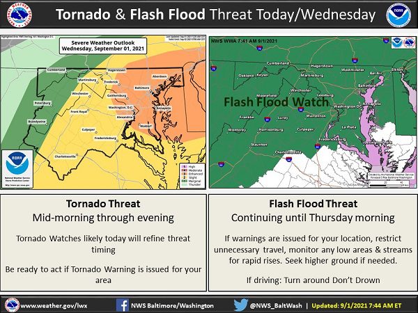
UPDATE: Governor Larry Hogan has directed MEMA to raise the state activation level and all Baltimore County Public Schools will dismiss three hours early on Wednesday.
Original story below…
——
NOTTINGHAM, MD—For those who were thinking about going to the Maryland State Fair on Wednesday, officials have announced that the fair will be closed on Wednesday due to potential tornadoes and flash flooding from Tropical Depression Ida.
The fair will reopen at noon on Thursday.
An initial round of storms dropped up to 2.5 inches of rain in parts of the Baltimore area overnight. A Tornado Watch was issued overnight but has since expired.
A Flood Warning is in effect for the Nottingham area until 10:45 a.m. on Wednesday. Doppler radar indicated heavy rain due to thunderstorms early this morning. Flooding is ongoing or expected to begin shortly in the warned area. Between 1.5 and 2.5 inches of rain have fallen. The Flood Warning may be extended or reissued as heavy bands of rain approach the area.
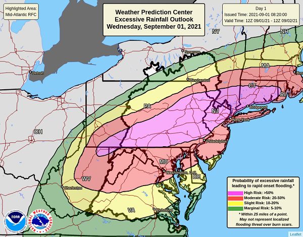
A large and rare “high risk” for excessive rainfall has been issued by the National Weather Service. The expected rain could produce dangerous flooding in a large area of the Mid-Atlantic basin.
Residents should remain weather-aware throughout the day.


We’re urging residents to be cautious during Tropical Depression Ida. Our team is here for you, and emergency officials are ready to respond.
Throughout the storm, you can follow us online for updates, at @BACOemergency and @BaltCoFire on Facebook: https://t.co/kN5R2I4uHS https://t.co/NRLg7ZAxsM
— County Executive Johnny Olszewski (@BaltCoExec) August 31, 2021
Significant & life-threatening flooding is forecast across the Mid-Atlantic into southern New England today ahead of T.D. Ida. 3-8 inches (with locally higher amounts) of rainfall will lead to widespread major flood impacts, especially in urban areas and areas of steep terrain. pic.twitter.com/jJ2mWcVcMl
— NWS Weather Prediction Center (@NWSWPC) September 1, 2021
Do you value local journalism? Support NottinghamMD.com today.

