UPDATE: Governor Larry Hogan has directed MEMA to raise the state activation level and all Baltimore County Public Schools will dismiss three hours early on Wednesday.
Original story below…
——
NOTTINGHAM, MD—Severe weather is likely on Wednesday and into Thursday as the remnants of Hurricane/Tropical Storm Ida move through Maryland.
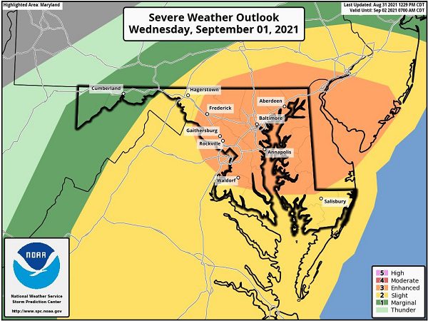
The Baltimore County Department of Emergency Management says that the chances for tornado activity and flash flooding have increased.
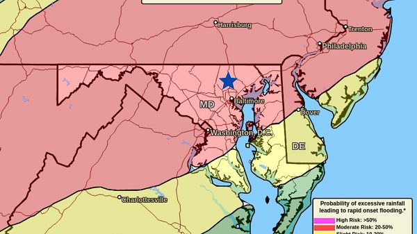
The National Weather Service is calling for 4 – 6 inches of rain from Wednesday afternoon through Thursday morning. The areas in red in the graphic below are at the greatest risk for flash flooding. A Flash Flood Watch remains in effect for the entire Baltimore metro area.
Forecasters say the “spin” in the atmosphere will be ideal for tornado formation. The areas in orange in the graphic above are most likely to see tornado development.
Residents should stay tuned to local forecasts.


Do you value local journalism? Support NottinghamMD.com today.

