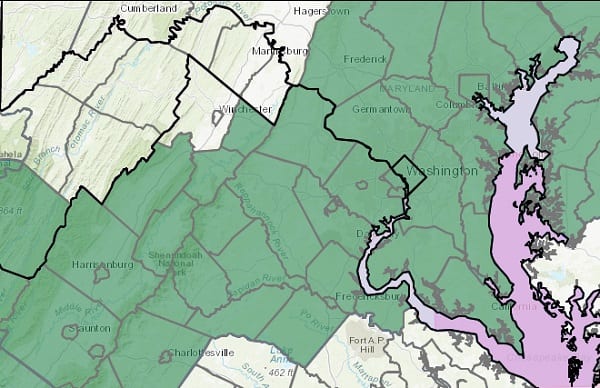
NOTTINGHAM, MD—The National Weather Service has issued a Flood Watch for portions of Maryland as the remnants of Hurricane/Tropical Storm Zeta approach the area.
The watch will be in effect from last Wednesday night through Thursday evening.
Heavy rainfall from Zeta could lead to some flooding of small streams, creeks, and urban areas. Rain amounts of 2 to 3 inches are expected with locally higher amounts possible, especially in the metro areas.
Scattered incidents of flooding due to heavy rain are possible. Clogged drains due to leaf debris may cause additional flooding concerns, especially in urban areas.
Motorists should not enter or cross flowing water or water of unknown depth. River banks and culverts can become unstable and unsafe.
A Flood Watch means there is a potential for flooding based on current forecasts. Residents should monitor later forecasts and be alert for possible flood warnings. Those living in areas prone to flooding should be prepared to take action should flooding develop.
As of 4 pm EDT Hurricane Zeta's maximum sustained winds are 110 mph. https://t.co/8LdT0RIp28
— NWS Eastern Region (@NWSEastern) October 28, 2020
Do you value local journalism? Support NottinghamMD.com today.

