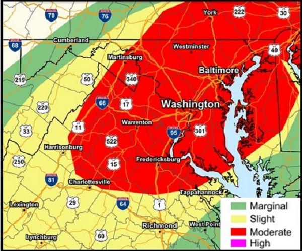
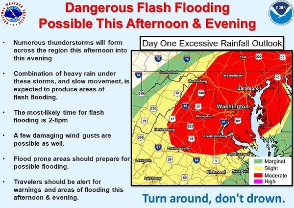
NOTTINGHAM, MD—The National Weather Service says dangerous flash flooding is possible in the Baltimore area on Wednesday.
There is higher than usual risk from flash flooding. Numerous thunderstorms will form around the region on Wednesday afternoon and through Wednesday evening. They will be slow moving, and produce localized areas of very heavy rain.
A Flash Flood Watch is in effect for this threat from noon to 11 p.m.
The most likely time for flash flooding within the watch period is 2 p.m. to 8 p.m. An isolated damaging wind gust is also possible in any thunderstorm.
Additional storms with localized heavy rain could form again in the early morning hours before dawn.
A very humid air mass over the Eastern US today will bring the threat for slow moving thunderstorms this afternoon & evening with the potential to produce torrential downpours & flash flooding across the mid Atlantic region and particularly along the I-95 corridor. pic.twitter.com/apBY9jcdyz
— NWS Eastern Region (@NWSEastern) August 12, 2020
Do you value local journalism? Support NottinghamMD.com today.


