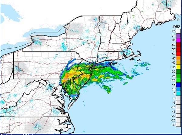
NOTTINGHAM, MD—Tropical Storm Fay is “buzzing the tower” in the Baltimore area on Friday as the storm creeps along the East Coast.
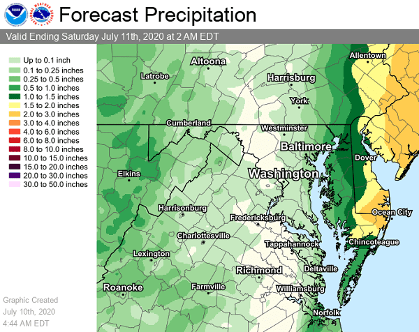
At around 5 a.m. on Friday morning, the National Weather Service said that Tropical Storm Fay would move northward along the coast throughout the day, with the heaviest rain expected to remain near and east of the Chesapeake Bay.
At just before 11:30 a.m., forecasters said moderate to heavy rain bands were filling the storms western and northern quadrants as the storm passed Ocean City.
These bands have now inched westward across the central Chesapeake Bay and are pushing into central and northeast Maryland.
Additional showers and storms will develop over the mountains Friday afternoon and evening.
A few instances of flooding are possible. Residents should stay tuned to their local forecast.
Meteorologists say this is the earliest in the hurricane season that an “F-named” (sixth) storm has developed.
CURRENT CONDITIONS: Assateague State Park is experiencing rain and windy conditions from #TropicalStormFay. Red flags are up today with NO SWIMMING permitted due to dangerous surf conditions and high risk of rip currents. Always use caution when near the ocean. pic.twitter.com/QUApAiqtpc
— Maryland DNR (@MarylandDNR) July 10, 2020
Do you value local journalism? Support NottinghamMD.com today.


