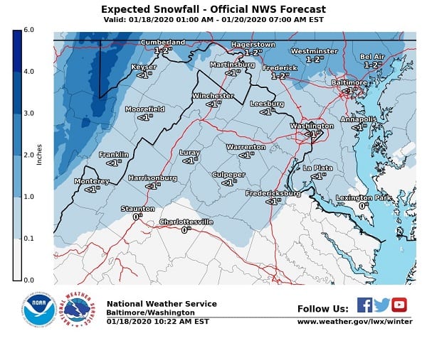
NOTTINGHAM, MD—The National Weather Service all but admitted that their snowfall forecast for the Baltimore area was a bust on Saturday.
As the morning hours passed by with little to no snow reaching the ground in many areas, the NWS tweeted out a revised forecast showing less than an inch of total accumulation for Baltimore – and that may even be on the high side.
Forecasters did say that sleet and freezing rain were still a risk as the afternoon hours unfolded, and many areas in the NottinghamMD coverage area were reporting that sleet was falling as of 1 p.m.
“Precipitation is moving across the area as temperatures remain near or just below freezing,” the National Weather Service said. “Where it is precipitating, any snow will begin to mix & change to sleet/freezing rain. Use caution this afternoon as untreated surface may be slippery.”
Pavement temperatures are slowly rising, but are still at freezing temperatures. Freezing rain is forecasted later. Take it slow, especially on bridges. #mdwx #mdtraffic cg
— MD State Highway Adm (@MDSHA) January 18, 2020
Precipitation is moving across the area as temperatures remain near or just below freezing. Where it is precipitating, any snow will begin to mix & change to sleet/freezing rain. Use caution this afternoon as untreated surface may be slippery. Latest: https://t.co/5RyZgoXicj pic.twitter.com/phEy5oatCm
— NWS DC/Baltimore (@NWS_BaltWash) January 18, 2020
Do you value local journalism? Support NottinghamMD.com today.

