 Winter strikes back!
After a winter without much precipitation, the season seems to poised to exact revenge.
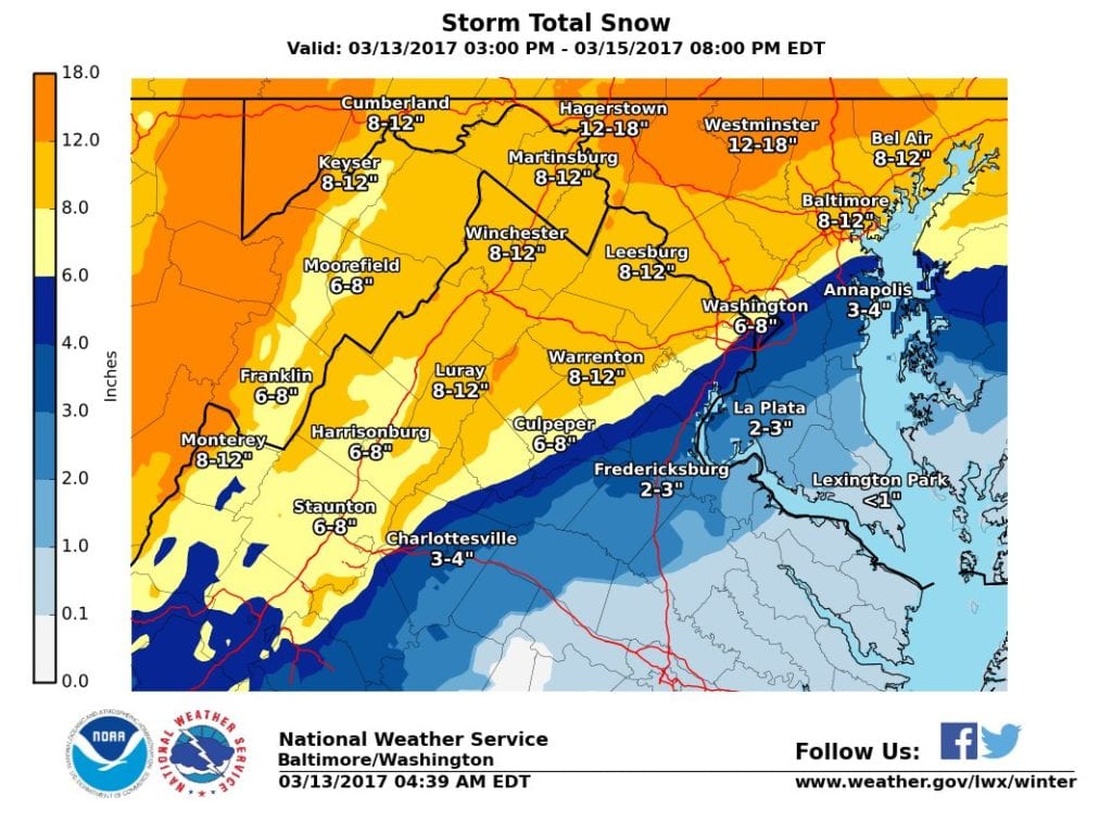
A strong storm system is expected to move up the coast sending lots of snow into the Nottingham area.
The precipitation is expected to begin between 8 p.m. and midnight on Monday night, continuing throughout the day on Tuesday.
The National Weather Service is predicting that the Baltimore area will receive 8 to 12 inches of snow before the system moves out late in the day on Tuesday.
A Winter Storm Warning has been issued and goes into effect at 7 p.m. on Monday evening.
When shoveling snow, Baltimore County officials are reminding residents to keep snow and ice 3 feet away from fire hydrants. In the event of a fire, firefighters need to be able to access the hydrants quickly in order to protect people and property.
Motorists are urged to stay off the roads during the height of the storm so crews can more easily clear highways. Driving could be dangerous soon after the snow begins. Additionally, residents should take the following actions:
· Closely monitor updated weather forecasts and keep electronic communications devices charged.
· Be cautious shoveling snow or ice to avoid overexertion. Take frequent breaks and keep hydrated.
· If you must travel, make sure to have car chargers, kitty litter or sand for traction. Let friends or family know of your travel route and expected arrival time.
· If it is safe to do so, consider clearing off roofs if significant snow has accumulated.
· Know who to contact in the case of a power outage. Emergency phone numbers for utility companies can be found here: http://mema.maryland.gov/Pages/PowerOutages.aspx
Baltimore County residents can obtain real-time storm-related info via this link.
Keep up with the latest via the National Weather Service by clicking here.


Do you value local journalism? Support NottinghamMD.com today.
