For the latest Tropical Storm Isaias coverage, click here.
NOTTINGHAM, MD—As of Monday evening, Tropical Storm Isaias continues to make its way toward Maryland.
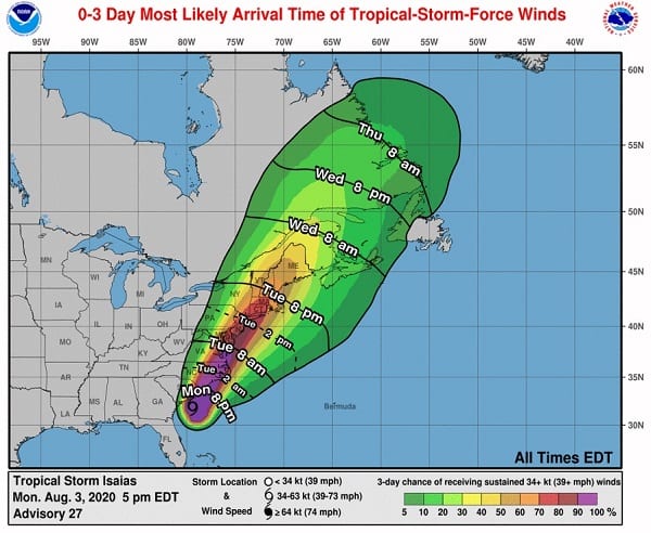
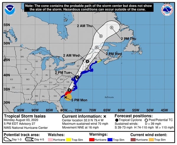
At 5 p.m., Tropical Storm Isaias was located 90 miles south of Washington, DC and will arrive in the Maryland area on Tuesday morning. The outer bands are already bringing rain and thunderstorms to portions of Maryland.
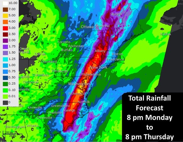
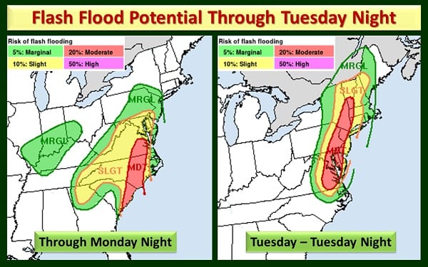
Residents can expect flash flooding with 4 to 8 inches of rain on the way. There will also likely be tree damage with wind gusts 50-70 MPH near and east of I-95, as well as coastal flooding.
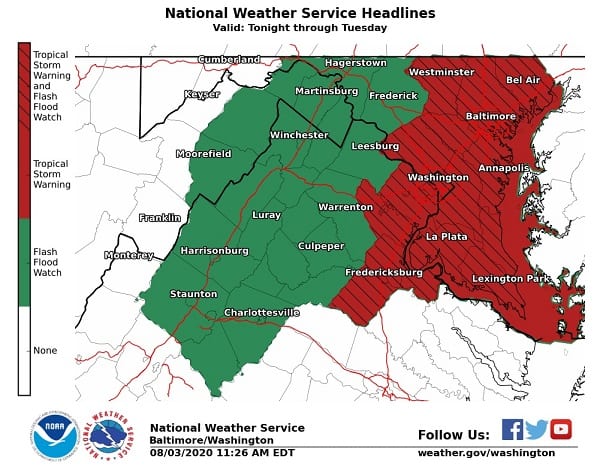
A Tropical Storm Warning is now in effect, along with a Coastal Flood Warning and Flash Flood Watch.
Additional updates have been provided by Governor Larry Hogan, Councilman David Marks, MEMA, and BGE. Additional maps and resources are available below.
For the latest Tropical Storm Isaias coverage, click here.
5 pm Monday…Tropical Storm Isaias was located 60 mi SSE of Charleston SC or 120 mi SSW of Myrtle Beach SC and is moving north-northeast at 16 mph. Max sustained winds are 70 mph. At 450 pm Buoy 41004 located 41 nmi southeast of Charleston, SC recorded a wind gust of 72 mph pic.twitter.com/xmNreBrrrU
— NWS Eastern Region (@NWSEastern) August 3, 2020
Do you value local journalism? Support NottinghamMD.com today.

